
Wind Turbine Transport Route Planning for Blades, Nacelles, and Towers
Wind components fail routes in three different ways: blades fail on sweep geometry, nacelles fail on weight and grade, towers fail on height. Planning a turbine delivery means solving all three across a hundred-plus kilometers of rural road that was never designed for any of them.
Three loads, one corridor, many jurisdictions
A blade trailer's rear steers a path no car-based map can predict — the constraint is swept geometry at every intersection and roundabout, not lane width. The nacelle behind it doesn't care about sweep but cares intensely about structure capacity and sustained grade. The tower sections care about overhead clearance. One corridor must work for all of them.
And the corridor is long. Turbine deliveries cross county lines, state or provincial lines, and utility territories, multiplying permit authorities — each expecting documentation of its own stretch. A gap in any segment stalls the whole campaign, with cranes and crews waiting at the site.
Planning a turbine delivery corridor
Screen the corridor before driving it
Route Intelligence overlays — structure density, bridge inventory — identify which parts of a long rural corridor actually need field verification.
Survey for component-specific constraints
Field teams document blade sweep conflicts at intersections, bridge capacities for nacelle axle loads, and overhead clearances for tower sections — as typed, GPS-tagged POIs.
Analyze grades for the heavy pieces
Grade profiles expose sustained climbs and long braking descents that govern nacelle transport, supporting escort planning and engineering sign-off.
Package for every authority
Permit route lists split by jurisdiction, turn-by-turn directions, and full PDF reports — plus a Client Delivery Portal link for the EPC and developer.
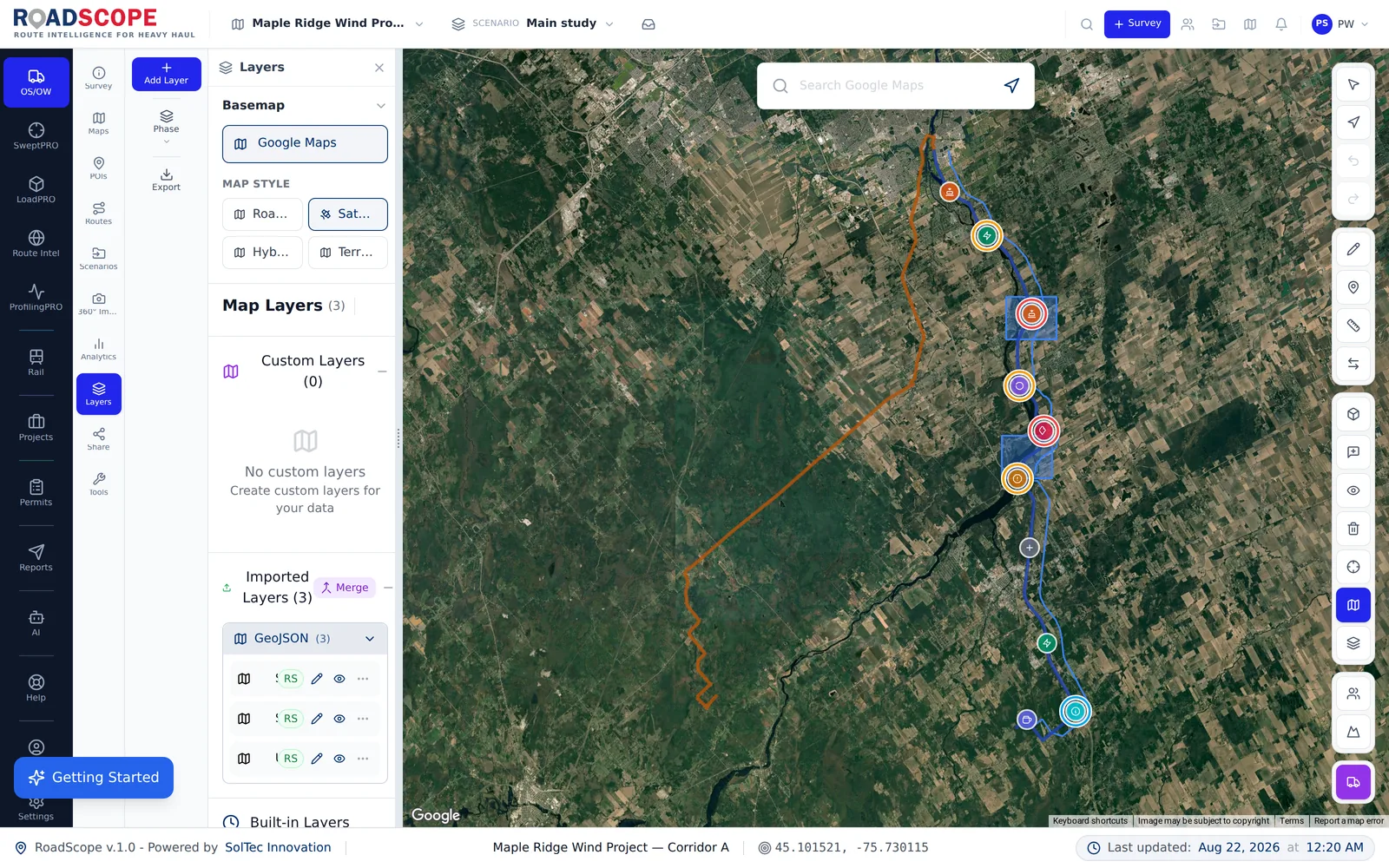
Example deliverable: the corridor feasibility package
A planned turbine corridor produces a package the whole project team works from:
- Corridor feasibility record covering blade, nacelle, and tower constraints separately
- Intersection-by-intersection sweep conflict documentation with photos
- Grade analysis for the heavy component moves
- Multi-jurisdiction permit package and stakeholder portal link
Component-aware planning vs. one-size route checks
| Spreadsheets, maps & photos | RoadScope | |
|---|---|---|
| Blade geometry | Judged by eye at "the tight ones" | Sweep conflicts documented per intersection as POIs with photos |
| Corridor length | Field crews drive everything | Overlay screening focuses verification where it matters |
| Multiple authorities | Documentation re-assembled per jurisdiction | Route lists split by jurisdiction from one record |
| Campaign reuse | Next site starts from scratch | Corridor records persist across a multi-site campaign |
Frequently asked questions
Can RoadScope handle a multi-site wind campaign?
Yes — projects track multiple routes simultaneously, so concurrent site corridors share a common record and surveyed segments are reused where corridors overlap.
How does RoadScope help with blade sweep specifically?
Field teams document sweep conflicts at each critical intersection as structured POIs — geometry notes, photos, and positions — so the constraint record travels with the route into reports and driver briefings.
Who sees the deliverables on a wind project?
Typically the carrier, the EPC, the developer, and permitting authorities. The Client Delivery Portal gives non-RoadScope stakeholders a live interactive map instead of a static PDF.
Related pages
See it on your own route
Book a demo to walk through the full workflow with your use case, or try MapPRO Light — the free, no-login map — right now.