
Truck Route Survey Software That Replaces the Spreadsheet Stack
Most truck route surveys are delivered by a stack of tools that were never designed for the job: a spreadsheet for constraints, a maps app for the line, a photo folder for evidence, and a word processor for the report. RoadScope is the purpose-built replacement — one system from field capture to the client's hands.
The real cost of the tool stack
The spreadsheet stack works until it has to be trusted. Constraint rows drift from the map because nothing links them. Photo evidence lives in filenames like IMG_4club.jpg that only the surveyor can decode. Producing the final report means hand-assembling all of it — and updating anything afterward means doing it again.
Clients notice. A survey delivered as attachments looks like the tools that made it, and every question ("which photo is that bridge?") costs a round-trip email. The deliverable quality caps the fee the work can command.
One system from capture to client
Capture into structure
Field observations enter as typed POIs — GPS position, measurements, photos attached — never as loose files to reconcile later.
Analyze in place
Grade profiles, Route Comparison, and the AI Analytics Advisor work directly on the survey records; there is no export-to-analyze step.
Generate the deliverable
Quick and Full PDF reports assemble the survey — map, POIs, photos, measurements — in minutes, from the live record.
Deliver interactively
The Client Delivery Portal shares the route as a live interactive map the client explores and signs off on — no software install, no attachment archaeology.
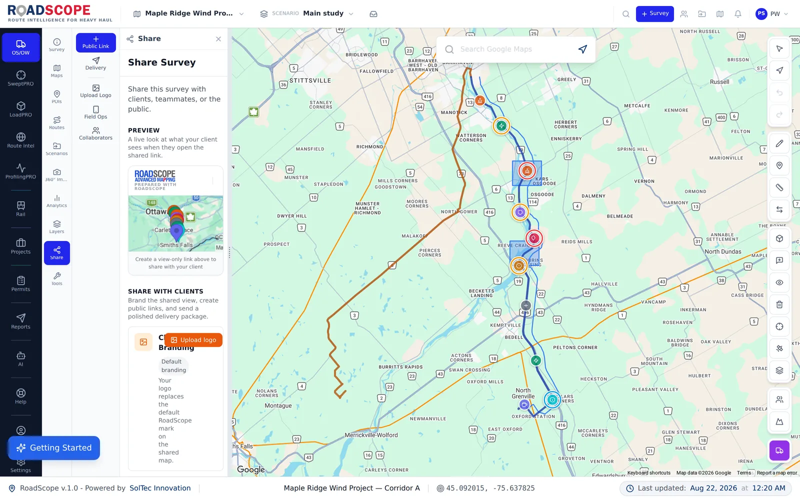
Example deliverable: the client survey package
A survey closed out in RoadScope ships as a coherent product:
- Interactive route map via the Client Delivery Portal
- Full PDF report with constraint inventory, photos, and measurements
- Exportable geodata (GeoPDF, KML, GeoJSON) for the client's GIS tools
- A persistent project record for follow-up questions and repeat moves
One platform vs. the spreadsheet stack
| Spreadsheets, maps & photos | RoadScope | |
|---|---|---|
| Data integrity | Spreadsheet, map, and photos linked by discipline alone | One record: POIs carry position, measurements, and photos together |
| Report assembly | Hours of copy-paste per deliverable | Generated from the live record in minutes |
| Revisions | Re-assemble the document set by hand | Update the record, regenerate the outputs |
| Client experience | Email attachments and clarification threads | Live interactive portal with the evidence attached |
Frequently asked questions
Who uses RoadScope for route surveys?
Route survey consultants, heavy haul carriers with in-house survey teams, escort operators who survey as a service, and engineering firms that need defensible route documentation.
Can I export data for clients who work in GIS?
Yes — surveys export to GeoPDF, KML, and GeoJSON, alongside the PDF reports and the interactive Client Delivery Portal.
How do I evaluate RoadScope before committing?
Book a demo to see the full workflow, or start with MapPRO Light — the free, no-login map — to get a feel for the mapping experience before moving to full surveys.
Related pages
See it on your own route
Book a demo to walk through the full workflow with your use case, or try MapPRO Light — the free, no-login map — right now.