
OS/OW Route Survey Software That Structures the Field
An OS/OW route survey produces hundreds of observations — clearances, corners, wirelines, staging areas, photos. Survey software earns its keep by structuring those observations as they are captured, so the office never has to reconstruct the field from notes and memory.
The field-to-office gap
Most route surveys still come back as raw material: photos with no coordinates, measurements scribbled per landmark, voice memos from the truck. The office then spends hours reassembling what the field already knew — and every reassembly step can introduce an error the permit application inherits.
The gap gets worse with scale. One surveyor on one route can hold it together; a team surveying multiple corridors in parallel cannot. Without structure at the point of capture, observations collide, duplicate, or vanish.
How RoadScope structures a route survey
Assign the survey
Survey Scheduling assigns routes and POI checklists to field team members — the assignment, not a briefing call, defines the work.
Capture structured observations
Every observation is a POI: typed (35+ types), GPS-positioned, measured, and photographed. MeasurePRO LiDAR captures verified overhead clearances.
Sync in real time
Field captures appear in the office project as they happen. No end-of-day data dump, no version conflicts, no lost observations.
Review and deliver
The office reviews the structured survey, runs analysis, and generates reports — from the same records the field created, with nothing re-typed.
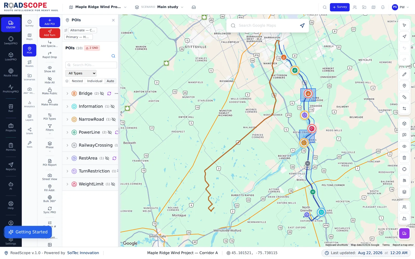
Example deliverable: the structured survey record
A finished survey in RoadScope is immediately usable, not raw material:
- POI inventory: every constraint typed, positioned, measured, and photographed
- Verified clearance measurements from MeasurePRO LiDAR capture
- Survey report (Quick or Full PDF) generated directly from the field records
- A shareable interactive map of the surveyed corridor
Structured capture vs. notes-and-photos surveying
| Spreadsheets, maps & photos | RoadScope | |
|---|---|---|
| Observations | Photos, notes, and voice memos to be sorted later | Typed POIs with GPS, measurements, and photos attached at capture |
| Office turnaround | Hours of reassembly before analysis can start | Data arrives structured and analysis-ready in real time |
| Team surveys | Merging several surveyors' folders by hand | One shared project; everyone captures into the same record |
| Clearances | Tape measures, poles, and posted signs | MeasurePRO LiDAR capture with GPS-tagged verification |
Frequently asked questions
Do I need special hardware to survey with RoadScope?
No — the mobile app captures GPS-tagged POIs and photos on its own. MeasurePRO LiDAR hardware adds verified overhead clearance measurement where you need measured values.
What is a POI in RoadScope?
A structured survey observation: a typed record (bridge, wireline, turn, staging area, and 35+ other types) with GPS position, measurements, photos, and notes — attached to the route, not floating in a folder.
Can the office see survey progress during the day?
Yes. Field captures sync in real time, so planners see observations as they happen and can redirect the field team before they leave the corridor.
Related pages
See it on your own route
Book a demo to walk through the full workflow with your use case, or try MapPRO Light — the free, no-login map — right now.