
Low Clearance Route Planning Beyond the Bridge List
Bridges are the low clearances everyone checks. The ones that catch over-height loads are everything else: utility wirelines sagging in summer heat, signal heads over the travel lane, sign structures at ramp gores. RoadScope treats the whole overhead corridor as the constraint — not just the structures with a sign on them.
The overhead constraints nobody publishes
There is no public database of wireline heights. Utility crossings, span wires, flashing beacons, and temporary service drops are invisible to every planning tool that works from published structure data — yet they are exactly what an over-height load meets between the bridges.
These constraints also move. A line that cleared last season may sag lower in heat or have been re-strung since. Planning an over-height corridor from memory of the last trip is planning from data that may no longer exist.
Surveying the full overhead corridor
Drive the corridor with MeasurePRO
Vehicle-mounted LiDAR captures the overhead envelope continuously — catching wirelines and structures that no database lists.
Type every overhead constraint
Wirelines, signals, sign structures, and bridges each become typed POIs with measured height, GPS position, and photos.
Screen against your load height
With the corridor documented, screening a specific load height against it is a data check, not a re-drive.
Brief the move
The Driver Briefing PDF sequences every clearance-critical point; utility coordination needs are visible with the measurements to back them up.
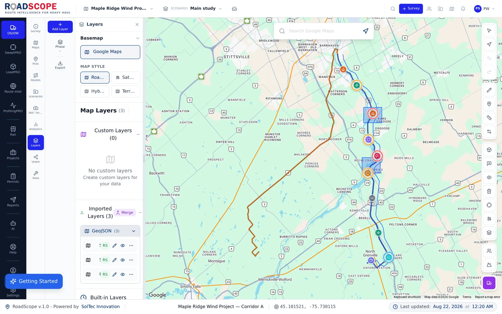
Example deliverable: the overhead corridor record
A surveyed corridor becomes a reusable overhead record:
- Continuous overhead constraint inventory — wirelines, signals, sign structures, bridges
- Measured heights with GPS positions and photo evidence for each constraint
- Screening result for the specific load height being moved
- Utility coordination list: which lines need lifting, with measurements attached
Corridor survey vs. bridge-list planning
| Spreadsheets, maps & photos | RoadScope | |
|---|---|---|
| Coverage | Published bridges only — wirelines invisible | Continuous LiDAR envelope of the whole corridor |
| Wireline heights | Unknown until the escort pole hits one | Measured, positioned, and photographed as POIs |
| Repeat moves | Re-drive the corridor each time | Screen new load heights against the documented record |
| Utility coordination | A guess at which lines are a problem | A measured list to hand the utility |
Frequently asked questions
How is this different from the bridge clearance page?
Bridge clearance planning starts from published structure inventories. Low clearance planning covers the constraints no inventory publishes — wirelines, signals, sign structures — which requires driving the corridor with continuous LiDAR capture.
Can I reuse a surveyed corridor for a future move?
Yes — that's the point of structuring the data. The corridor record persists in the project, and a future load height is screened against it, with re-verification only where conditions may have changed.
Does RoadScope alert the driver at low clearances?
RoadScope Navigator, connected to the surveyed route, provides POI hazard alerts during the move — built from the same clearance records captured in the survey.
Related pages
See it on your own route
Book a demo to walk through the full workflow with your use case, or try MapPRO Light — the free, no-login map — right now.