
Bridge Clearance Route Planning With Verified Heights
Every over-height move is a series of bridge decisions. Posted clearances are conservative, sometimes stale, and occasionally wrong in the dangerous direction. RoadScope combines bridge inventory reconnaissance with field-verified LiDAR measurement so each structure on the route is a known quantity, not a posted guess.
The trouble with posted clearances
Posted bridge clearances are a starting point, not an answer. Signs round down by different conventions, resurfacing quietly consumes inches, and the lowest point of a structure is often not where the sign implies. For a load running close to the limit, the difference between the posted number and the measured number is the whole game.
The reverse problem costs money too: treating every posted clearance as gospel forces detours around structures the load would actually clear — adding miles, jurisdictions, and permit complexity that a measurement would have avoided.
How RoadScope handles bridge clearances
Reconnoiter with inventory data
Route Intelligence overlays bring bridge inventory data onto the corridor before anyone drives it, so you know which structures matter for your load height.
Verify the critical structures
MeasurePRO LiDAR captures the actual clearance envelope of each critical structure — measured, GPS-tagged, and photographed.
Document each structure as a POI
Every bridge becomes a structured record: verified height, measurement position, photos, and notes — attached to the route.
Decide and record
Clear, detour, or investigate further: each clearance decision is visible on the route and carried into reports and driver briefings.
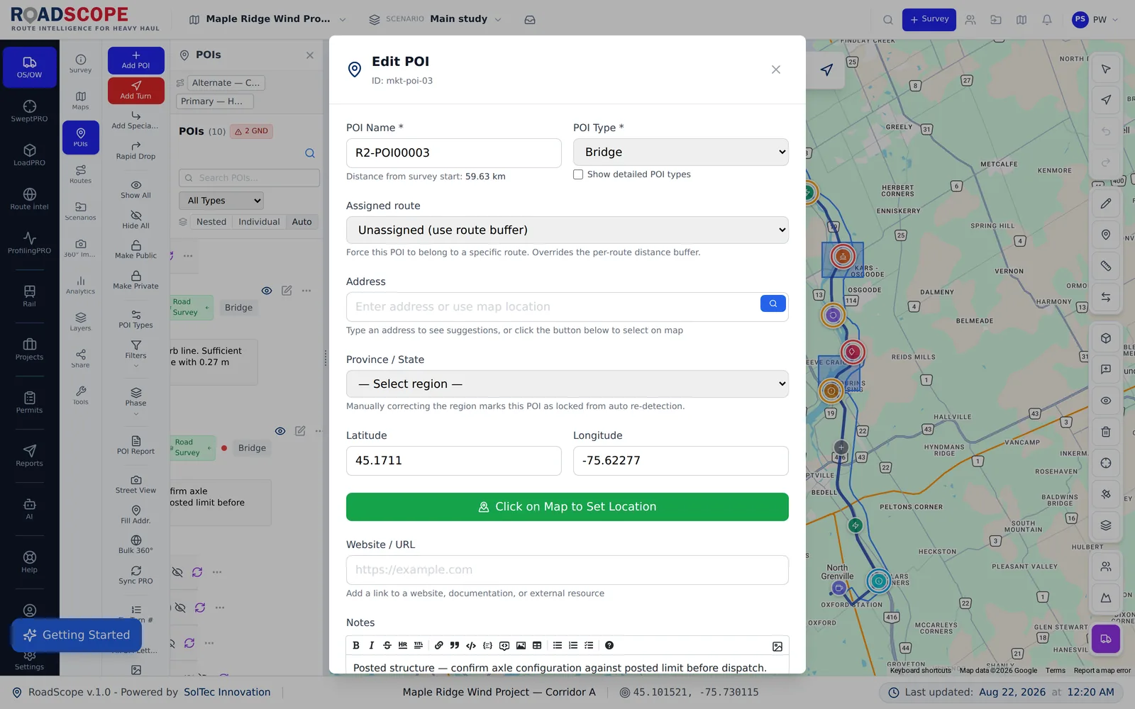
Example deliverable: the clearance record
For an over-height move, the route package documents every overhead decision:
- Bridge-by-bridge clearance inventory with verified measurements
- GPS-tagged photo documentation of each critical structure
- Route map distinguishing verified structures from inventory-only data
- Driver Briefing PDF flagging every clearance-critical point on the route
Verified clearances vs. posted-sign planning
| Spreadsheets, maps & photos | RoadScope | |
|---|---|---|
| Clearance source | Posted signs and public databases of varying age | Inventory data for reconnaissance, LiDAR verification where it matters |
| Marginal structures | Detour by default — or risk it | Measure, then decide on the actual number |
| Records | A note that "the bridge on Route 9 is fine" | A POI with the measured value, position, date, and photos |
| Driver awareness | Verbal warning about the low one | Every clearance-critical point in the Driver Briefing PDF |
Frequently asked questions
Does RoadScope include a bridge height database?
RoadScope brings bridge inventory data into the corridor view for reconnaissance, and structures your own verified measurements on top of it. For loads near the limit, the verified measurement is the number that counts.
How accurate is MeasurePRO clearance capture?
MeasurePRO uses vehicle-mounted LiDAR to capture the overhead envelope, producing measured clearances tied to GPS position — replacing pole-and-tape spot checks with a continuous measured record.
What about wirelines and signals, not just bridges?
The same workflow applies — overhead wirelines, signals, and other vertical constraints are their own POI types with the same measurement and photo structure. See the low-clearance route planning page for that broader workflow.
Related pages
See it on your own route
Book a demo to walk through the full workflow with your use case, or try MapPRO Light — the free, no-login map — right now.