
Oversize Load Route Planning Software
Consumer navigation apps route cars. Trucking planners route legal loads. Neither knows what happens when your load is 16 feet tall and 200 feet long. RoadScope is route planning software built specifically for oversize loads — where the route is only as good as the constraint data behind it.
Why generic routing tools fail oversize loads
An oversize move fails at a single point: the one overpass, wireline, or corner nobody verified. Generic mapping tools have no concept of vertical clearance at your load height, turning geometry for a multi-axle configuration, or which jurisdiction requires which permit along the way.
Most teams compensate with a patchwork — a web map for the line on the map, a spreadsheet for constraints, a photo folder from the drive-through, and email threads to hold it together. Every handoff between those tools is a place where a measurement gets lost or an outdated assumption survives into the permit application.
How RoadScope plans an oversize route
Build the route against real constraints
Draw or import the route, then work it against structured constraint data: 35+ POI types for bridges, wirelines, signals, turns, and staging areas — each with position, measurements, and photos attached.
Verify the critical points
Field-verify overhead clearances with MeasurePRO LiDAR capture and GPS-tagged photo documentation, so the plan rests on measured values instead of assumptions.
Compare route options side-by-side
Route Comparison View puts alternatives next to each other across clearances, grades, and permit complexity, so the routing decision is documented — not just made.
Hand off a complete package
Generate permit route lists by jurisdiction, turn-by-turn directions, Driver Briefing PDFs for the crew, and a Client Delivery Portal link for stakeholders.
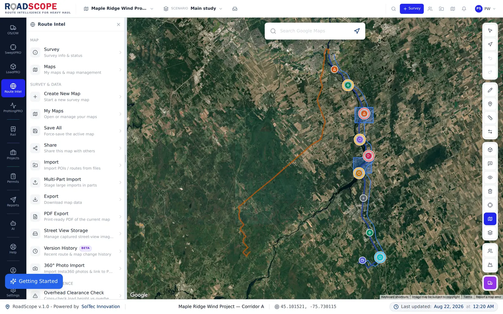
Example deliverable: the oversize route package
A completed plan in RoadScope produces one coherent package instead of scattered files:
- Route map with every documented constraint POI (clearances, turns, staging areas)
- Permit route list organized by jurisdiction for the application
- Turn-by-turn directions extracted from the actual planned geometry
- Driver Briefing PDF the crew takes on the road
- Live interactive map link for the client — no software required on their side
RoadScope vs. the spreadsheet-and-maps approach
| Spreadsheets, maps & photos | RoadScope | |
|---|---|---|
| Constraint records | Spreadsheet rows detached from the map; photos in a separate folder | Structured POIs with GPS position, measurements, and photos on the route itself |
| Clearance confidence | Posted signs and memory of the last trip | Field-verified LiDAR measurements captured with MeasurePRO |
| Route alternatives | Re-planned from scratch in a separate map tab | Side-by-side Route Comparison View with the same constraint data |
| Handoff to driver and client | Email attachments and verbal briefings | Driver Briefing PDF plus a live Client Delivery Portal link |
Frequently asked questions
Is RoadScope a truck navigation app?
No. RoadScope is route planning and documentation software. It exposes clearance risks, geometry constraints, and jurisdiction complexity before the move — and RoadScope Navigator can then turn the surveyed route into turn-by-turn convoy guidance connected to that intelligence.
Where does the clearance data come from?
From your own field verification. RoadScope structures MeasurePRO LiDAR measurements and GPS-tagged survey observations into POIs, supplemented by Route Intelligence data overlays such as bridge inventory data for reconnaissance.
Can I plan a route without doing a field survey first?
Yes — you can build and compare route options against data overlays first, then use the plan to prioritize which structures actually need field verification before the move.
Related pages
See it on your own route
Book a demo to walk through the full workflow with your use case, or try MapPRO Light — the free, no-login map — right now.