



Oversize Load Route Planning andHeavy Haul Survey Software
Built for specialized carriers, route surveyors, and project logistics teams: plan, survey, validate, and document OS/OW routes in one platform. We call it Route Intelligence — every clearance, constraint, photo, and decision about a route, kept in one place your whole team can work from.

Route Approved
Permit-ready status
Bridge Intelligence
Multi-region data coverage
OS/OW route knowledge shouldn't live in five disconnected places
Most teams plan and document oversize routes across disconnected maps, spreadsheets, photo folders, PDFs, and email chains. Every handoff loses detail — and the details are exactly what gets a load stopped under a bridge or a permit application sent back.
RoadScope replaces that patchwork with a single workflow: plan the route, survey it in the field, validate clearances and constraints, and deliver a professional route package — all from one platform your whole team shares.
- Centralize all route information in one place
- Collect field data and photos on mobile
- Document clearances and constraints with evidence
- Compare route options side by side
- Coordinate survey teams and collaborators
- Brief drivers with clear route instructions
- Deliver professional route packages to clients
- Keep a searchable history of every route
One Route. One Truth.
Nobody else connects it all — one live ecosystem
Measure It.
MeasurePRO · ProfilingPRO
- ± 2 mm at highway speed
- LiDAR envelope profiles
- No lane closure
Map It.
RoadScope · SweptPRO · LoadPRO
- Live sync from the truck
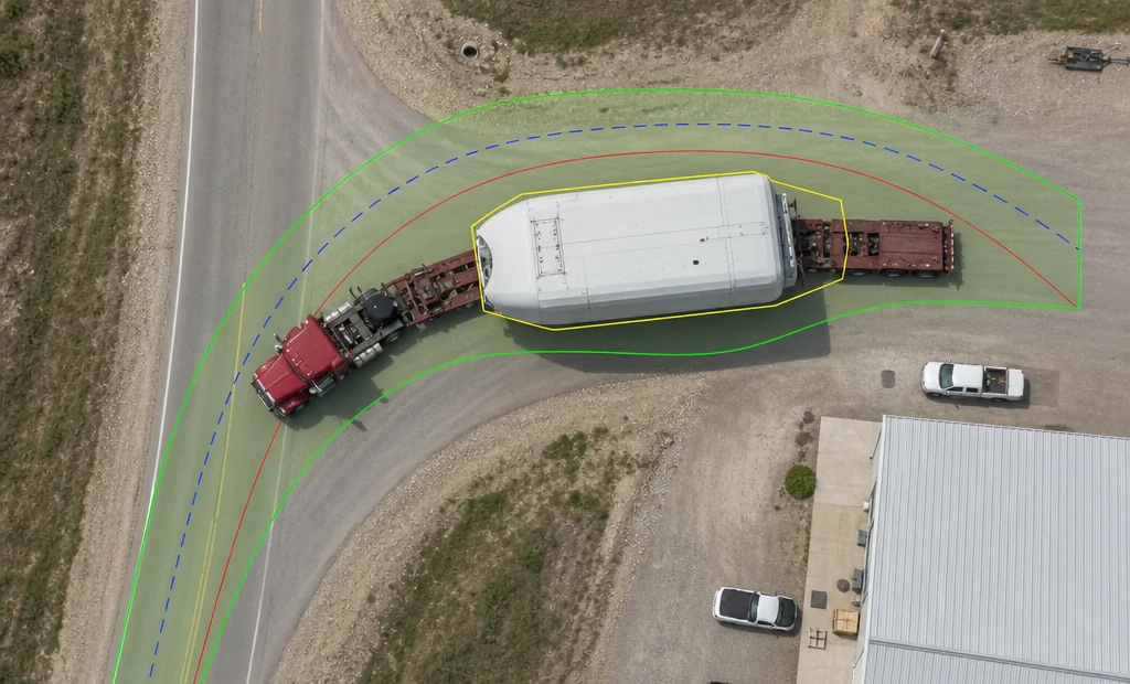
- Swept path + vertical verdicts
- 3D photorealistic convoy
Move It.
NAV · Convoy Guardian
- Turn-by-turn for the load
- Offline mesh crew alerts
- Bridge-strike prevention
Prove It.
Reports · Permits
- Interactive HTML Report Suite
- 50+ report sections
- One vendor. One truth.
Join us for
BreakbulkAmericas
The region’s largest project cargo & breakbulk event.
Join us and meet the team behind One Route. One Truth.
Industry Standard
Trusted by OS/OW Professionals
From independent surveyors to enterprise fleets, RoadScope powers route intelligence across North America and Europe
Trusted by Leading Organizations


Serving Key Industry Segments
Heavy Haul Carriers
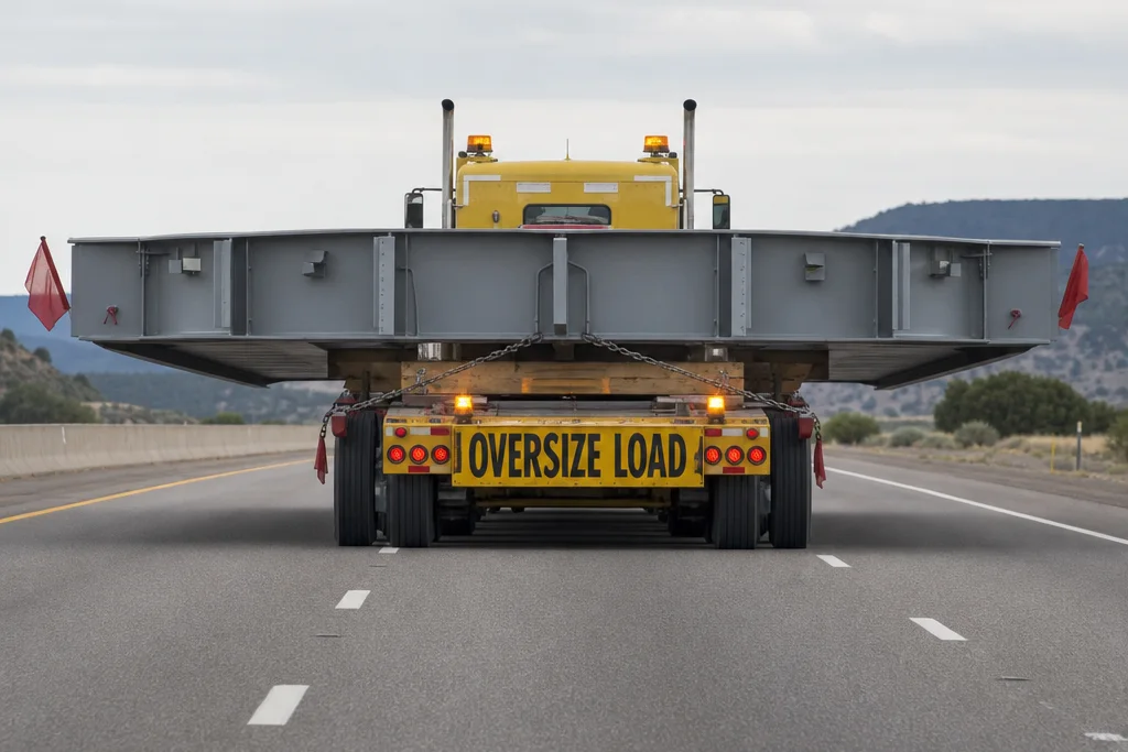
Oversized load transport
Route Surveyors
Professional field surveys
Permit Consultants
OS/OW permit specialists
Engineering Firms
Infrastructure planning
Escort Services
Pilot car operations
Fleet Managers
Multi-vehicle coordination
What Customers Say
Proven in the field, quoted by the people who ran the loads
Attributed results from real OS/OW projects documented in our case studies.
“RoadScope transformed how we approach OS/OW route planning. What used to take weeks of back-and-forth with permit offices now happens in days.”
“The bridge documentation alone saved us from the permit delays we've experienced before. RoadScope paid for itself on the first project.”
“RoadScope didn't just improve our operations — it changed how clients perceive us. We're now competing for contracts we couldn't have touched before.”
One connected pipeline, end-to-end
A single field-to-permit route: capture, profile, simulate, plan loads, document in RoadScope, deliver, execute, then hand off for permitting.
- Step 1SolTecField operationsField operations
- Step 2aMeasurePROLiDAR field captureHardware
- Step 2bProfilingPRORoad-profile captureAvailable
- Step 2cSweptPROSwept-path analysisEnterprise
- Step 2dLoadPROAxle-load planningIn development
- Step 3RoadScopeRoute intelligence hubPlatform hub
- Step 4Client PortalInteractive deliveryAvailable
- Step 5SolTecNAVConvoy executionOperator+
- Step 6Nova PermitsExternal permitting partnerExternal partner
Not just a mapping tool. A complete operations platform.
RoadScope is the central intelligence layer in a purpose-built heavy-haul operations ecosystem — connecting field capture, route analysis, team collaboration, client delivery, and convoy execution into a single, connected workflow.
Where generic tools stop at "how do I get from A to B," RoadScope answers the real questions: Can this specific load safely traverse this route? What are the documented constraints? What permits are required? What does the client need to see? What do drivers need on the road?
Created by SolTec Innovation Inc., RoadScope connects optional MeasurePRO LiDAR field capture, route intelligence and client delivery, and SolTecNAV convoy execution in a purpose-built heavy-haul workflow.
Note: RoadScope is not a navigation app, a dashcam product, or a generic fleet tracker. It is professional route intelligence infrastructure for the OS/OW industry.
Who Uses RoadScope?
The complete platform for everyone in the heavy-haul chain
Heavy Haul Carriers & Fleet Managers
Route Surveyors & Field Teams
Permit Specialists & Consultants
Escort & Pilot Car Operators
See RoadScope In Action
Current RoadScope workflows for route planning, field evidence, team coordination, permit requirements, and client-ready reporting

Route & POI Workspace
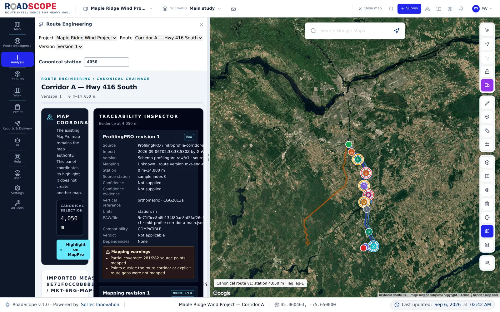
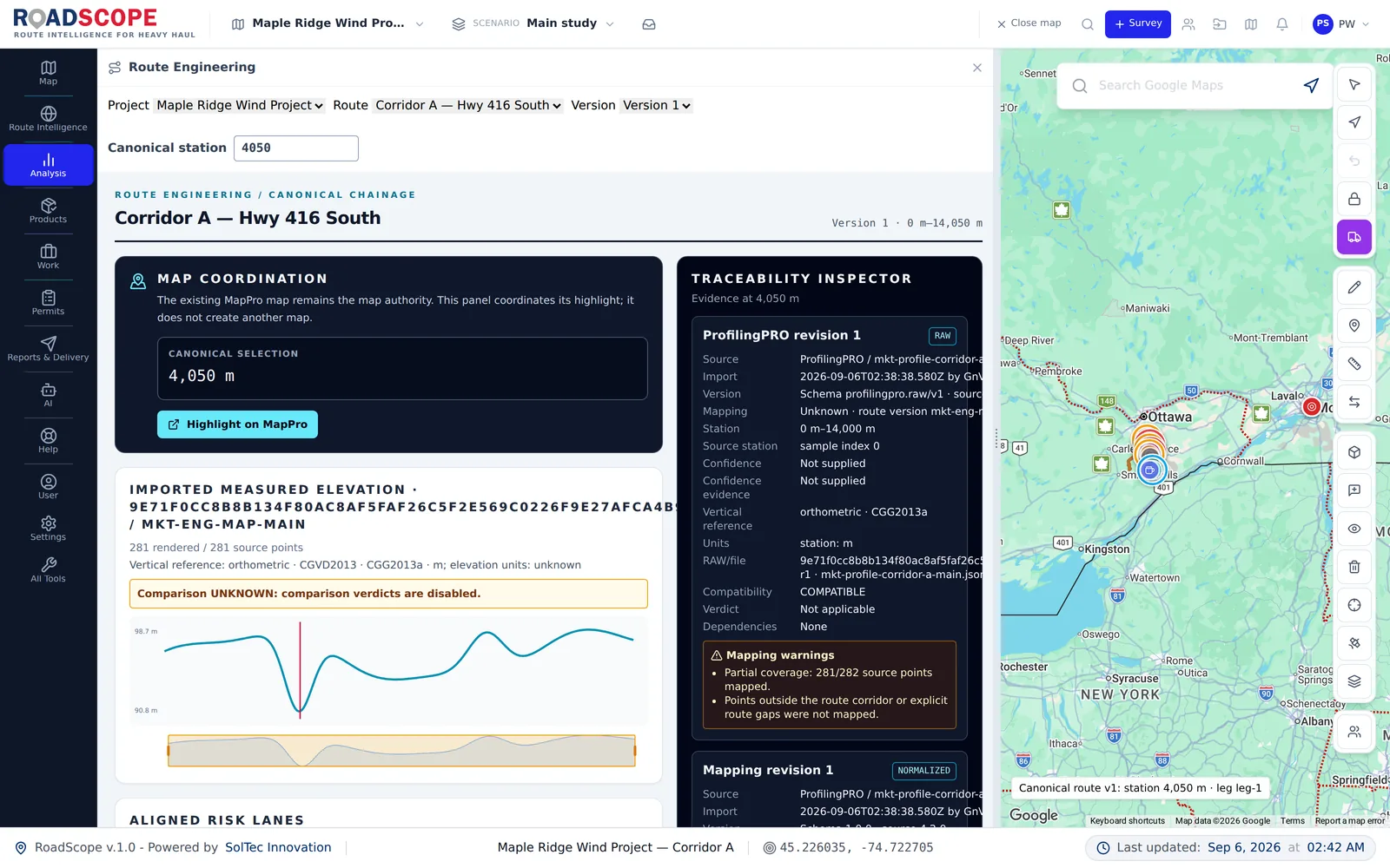
Review an active route, satellite context, and structured constraint POIs together

Mapping & Layers
Overlay project and GIS data to evaluate a corridor in operational context

Route Management
Organize and compare multiple route records within the same project

Reports Hub
Build interactive, client-ready reports directly from the shared route record

OS/OW Requirements
Keep jurisdiction requirements and permit planning alongside the route
The industry evolved. The tools hadn't.
Heavy-haul has always demanded more than maps — it demands intelligence.
But the tools used to plan, survey, document, and deliver routes were built for cars, analysts, or contractors who had never seen an OS/OW operation.
RoadScope exists because the gap was costing the industry money, moves, and trust.
Heavy Haul & OS/OW Transporters
Move with confidence — clearances documented, permits prepped, drivers briefed
Wind Energy Logistics & EPCs
Blade sweep, nacelle weight, rural grades — analyzed and delivered
Engineering Consultants & Surveyors
Professional documentation your clients can see, trust, and act on
Escort Providers & Route Planners
Live convoy intelligence, not assumptions and paper maps
What RoadScope Delivers
Every feature designed around real OS/OW workflows
Route Intelligence
Not just directions
Risk Visibility
Not assumptions
Professional Maps
Not screenshots
Defensible Decisions
Not guesswork
OS/OW-Specific Route Mapping
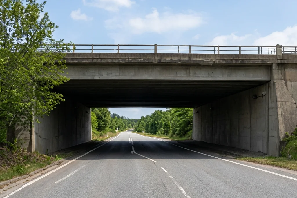
Map routes with vertical/horizontal clearance risks, tight geometry, sensitive zones, and rural road exposure — built for permit strategy and operational planning.
Elevation & Grade Analysis
GPS-based elevation profiles to identify steep grades, critical transitions, traction risks, and braking zones — essential for wind components and heavy modules.
Professional POI System
Industry-specific points of interest: bridges, culverts, overhead utilities, critical intersections, staging areas, escort transitions — each POI becomes part of your technical record.
Engineering-Grade Maps
Professional maps for permit applications, client approvals, driver briefings, and compliance reviews — designed to be shared, archived, and defended.
Project-Based Collaboration
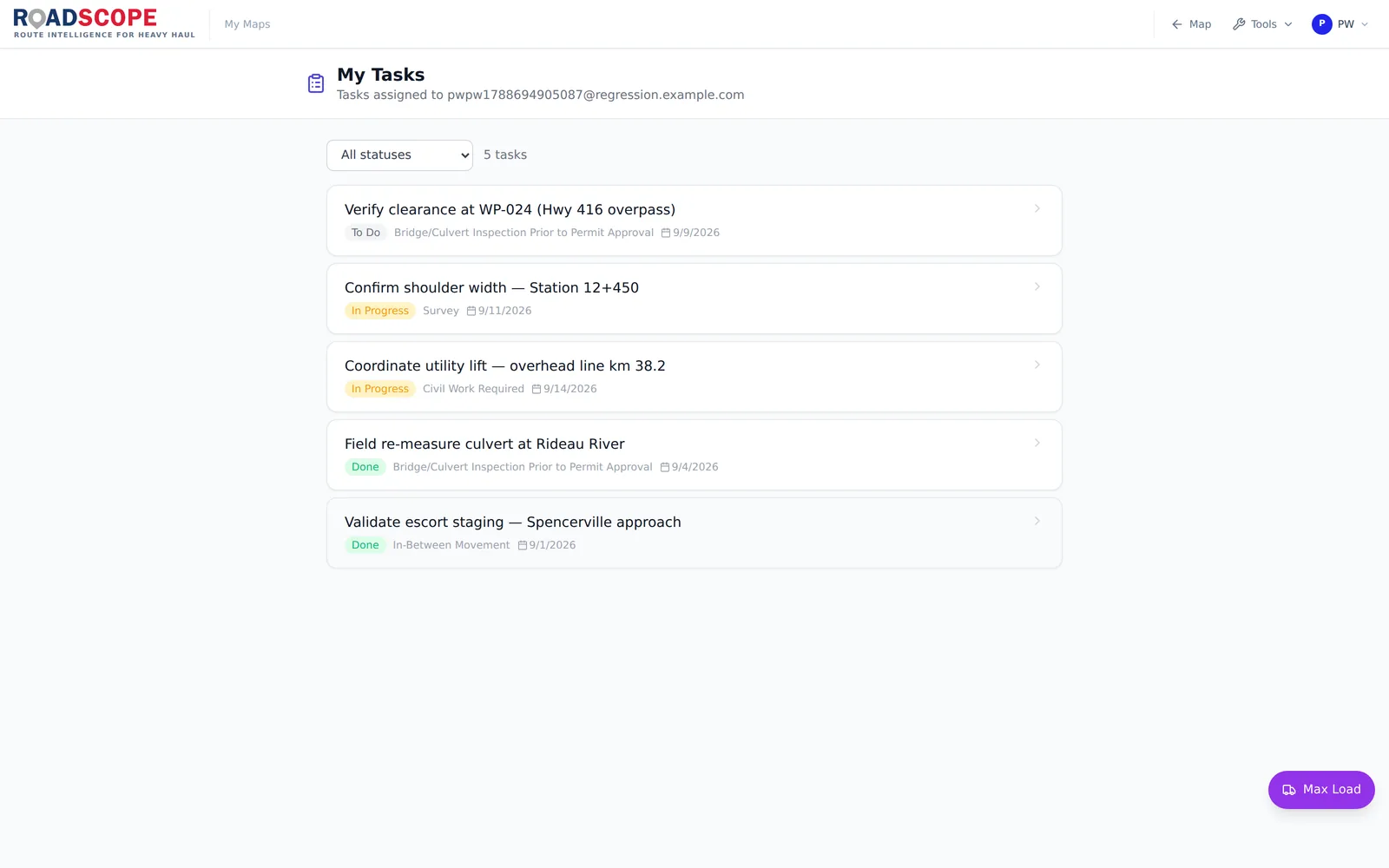
Share routes and maps by project, control access by role, maintain a single source of truth as routes evolve — no more fragmented files or conflicting versions.
Field + Office Workflows
Bridges field surveys with office planning, permits, and decision-making. Complements AutoTURN, LiDAR, and engineering workflows.
360° Street View Add-on
Capture, process, and navigate 360° street-level imagery along your route corridors. Inspect structures, clearances, and road conditions remotely without additional software.
AI-Ready Surveys
Every report and export carries an "Ask this survey with your AI" door — a QR code and link that connect the survey to Claude, ChatGPT, Gemini, or Copilot. Scoped to one survey, read-only, revocable. Available as an add-on.
SolTecUSA Bridge Inventory Add-on (USA)
Overlay bridge inventory data on your routes — posted weight limits, deck conditions, vertical clearances, and bridge authority contacts for all US states.
SolTecWorld Structure Analysis Add-on
Query and overlay structure data (bridges, culverts, tunnels, overpasses) directly on route maps for rapid pre-survey reconnaissance.
International Route Intelligence
Expanded international data coverage: SolTecCAN (Canada bridges), SolTecON (Ontario events), SolTecDE (Germany bridges), SolTecFR (France road structures), SolTecNL (Netherlands road network), and SolTecDOT (state events for NY, TX, OH, MI, IL).
Camera-Bridge Windows Service
Lightweight Windows service that bridges 360° and action cameras (GoPro, Ricoh Theta, Insta360) to your RoadScope field workflow — automatic transfer, GPS extraction, and processing queue.
Weather-on-the-Way
Per-route, per-segment weather risk reports with operational risk banners (Good to Travel / Use Caution / High Weather Risk / Do Not Dispatch). Includes a quick A→B weather check for any candidate route.
NAV Live Dispatch
See active SolTecNAV surveyors live on the office map and push a revised route directly to a specific surveyor. Field teams Accept to switch instantly or Save for Later — even after going offline.
Multi-Phase Workflow
Tag every POI and route as Preplan, Road Survey, or SharedMap. The phase filter controls both sidebar and map at once, and bulk per-type phase switching keeps large surveys tidy.
Client Delivery Portal
Hand clients a live, branded interactive Shared Map of the survey via a single link — including the elevation profile, POI badges, and an Envelope tab that recomputes pass/fail clearances against the client's entered load height. No software required on their side.
MeasurePRO Pairing & Real-Time Sync
Generate a 7-day RS-XXXXXX pairing code so field crews can link a MeasurePRO device to your survey and stream POIs back automatically. Real-time sync status and per-survey collaborator management included.
Unified Distance Units
A single Miles/KM preference now drives every distance display in the app — measuring tool, route distances, directions, Street View. Short measurements show meters or feet automatically.
Rail Crossings & Sidings
North America-wide rail crossing and siding coverage — at-grade, grade-separated, and siding locations from external route intelligence sources. Surface crossing locations, warning device types, and surface conditions directly on your route maps.
RI Dimension Filtering & Area Scans
Filter Route Intelligence findings by load height and width (Match / Excluded / Unknown), scan any drawn map area, and export normalized Height/Width columns in Excel and POI reports.
AI Report Studio
Draft survey reports with AI assistance using your own PDF/DOCX/HTML template, refine through revision chat, and pass a pre-publish quality gate before anything ships to a client.
Max Load AI Assistant
Launch the Max Load AI assistant straight from the map tool palette — it analyzes maximum load envelopes against your survey data, with every proposed action reviewed before it runs.
From survey planning to client delivery
Plan routes, organize field surveys, evaluate clearances and swept paths, manage permit documents, and publish client-ready evidence from one shared project. Availability varies by plan and add-on; the Features and Pricing pages show the current access level for each workflow.
Field-Grade Data Capture
RoadScope integrates with field data sources such as MeasurePRO — a LiDAR-based capture system purpose-built for OS/OW surveys — to collect verified clearance and constraint data directly in the field.
LiDAR-Based Surveys
Connect LiDAR-based clearance surveys directly into projects for verified measurements.
Reduce Manual Errors
Eliminate manual entry and transcription errors with direct field-to-platform data flow.
Full Traceability
Maintain complete traceability from field capture to permit-ready deliverables.
MeasurePRO is an optional hardware system for teams that require field-grade measurement accuracy.
SolTecNAV
Turn-by-Turn Execution for OS/OW Convoys
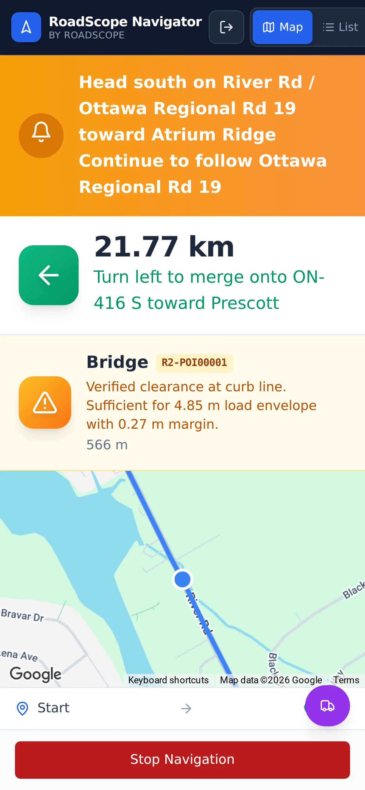
SolTecNAV is the convoy execution layer of the RoadScope platform. Export surveyed routes to mobile devices for real-time turn-by-turn navigation, hazard alerts, and convoy coordination. Drivers get the route — project managers retain control.
Built For Your Industry
Tailored solutions for every OS/OW operation
Heavy Haul & OS/OW Transport
- •Identify clearance and geometry risks early
- •Build defensible routes before permit submission
- •Produce maps drivers and escorts can actually use
Wind Energy Logistics
- •Analyze grades for tower sections, blades, and nacelles
- •Document constraints across long rural routes
- •Support EPCs and authorities with clear deliverables
Engineering & Consulting
- •Centralize route intelligence and POIs
- •Support reports with professional cartography
- •Reduce rework and liability exposure
Escort & Field Survey Teams
- •Capture and structure field observations
- •Share updates instantly with planners
- •Replace notebooks and screenshots with usable data
Real-Time Team Collaboration
Share routes and surveys with your team, clients, and stakeholders — with controlled access and version control.